
My Kentucky Home Provides What I Need

How Natural Resources and Landforms Determined Settlement and Farm Types in Kentucky
Why is this important?
The availability of natural resources, climate, and physical land characteristics determined where humans settled, and where civilizations and communities grew. It also determined and will continue to help determine where businesses locate. An abundance of resources, whether natural, human, or capital, impacts the economic success of a business and communities.
Kentucky Academic Standards
Social Studies (Economics and Geography) & Science (Earth Systems)
for Grades 4, 5 and Middle/High School Enrichment
4.E.IC.1 Describe and evaluate the relationship between resource availability, opportunity costs, migration and settlement.
4.E.KE.1 Predict how producers in colonial Kentucky used the factors of production to make goods, deliver services and earn profits.
4.G.GR.1 Analyze how location and regional landforms affect human settlement, movement and use of various national resources, using maps, photos and other geographic representations.
4.G.KGE.1 Compare how the movement of people, goods and ideas in Colonial America and modern Kentucky were affected by technology.
5.G.GR.1 Use a variety of maps, satellite images and other models to explain the relationships between the location of places and regions and their human and environmental characteristics.
5.E.ST.1 Explain how specialization, comparative advantage and competition influence the production and exchange of goods and services in an interdependent economy.
ESS2 and ESS3 - Earth's features, water, and natural resources.
Time Duration
2 60-minute sessions
Purpose
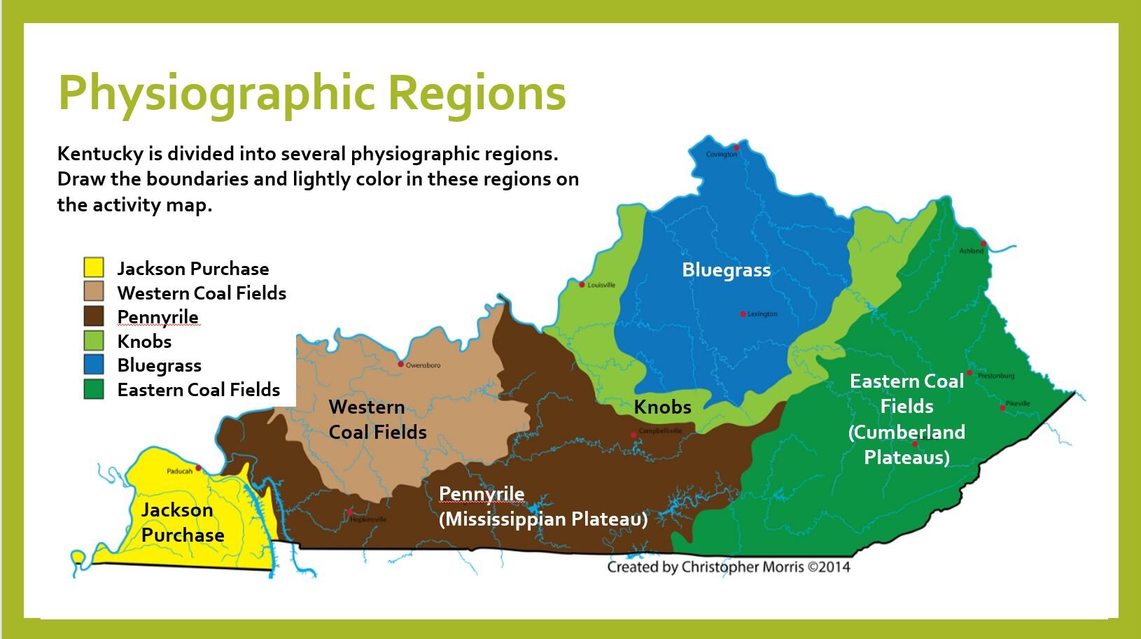
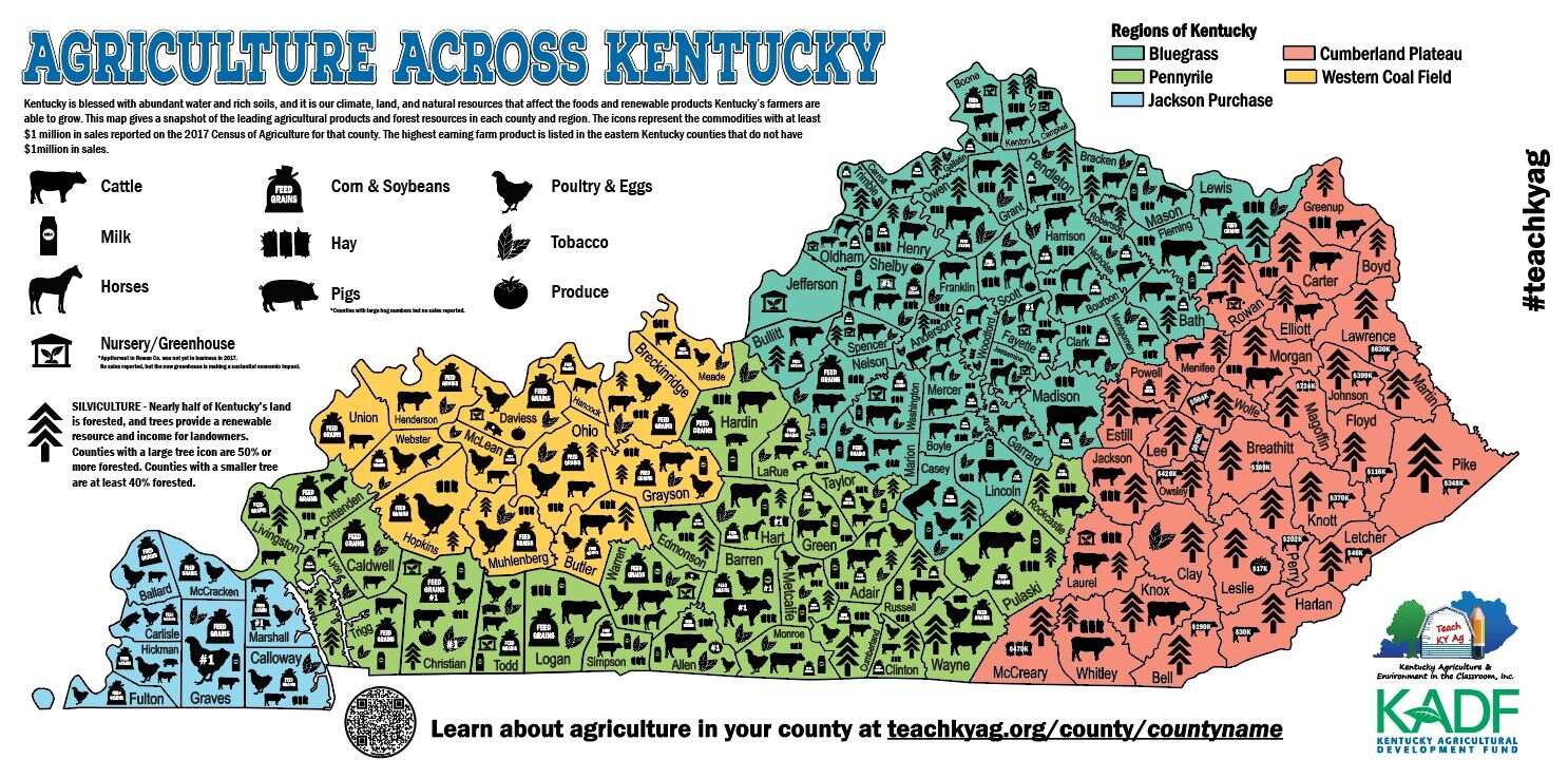
Students will map locations of natural resources and land types within Kentucky.
Students will analyze their maps to determine:
how these resources and land types affect where agricultural businesses are located.
economic viability, opportunity, and limitations of certain areas.
Resources & Materials Needed
Google Slide Presentation/Teacher’s Guide
Regions Map Activity Sheet
OPTIONAL - Descriptions of Kentucky’s Regions
Natural Resources Map Activity Sheet
Ag Production Map Activity & Production Data
Locate the Farm Activity Sheet - Answer Key
Students will also need crayons, colored pencils, or markers.
NOTE: To manipulate the Google Drive files, you must save a copy to your Google Drive/Classroom.
Lesson Snapshots


The video below is also included in the lesson presentation.